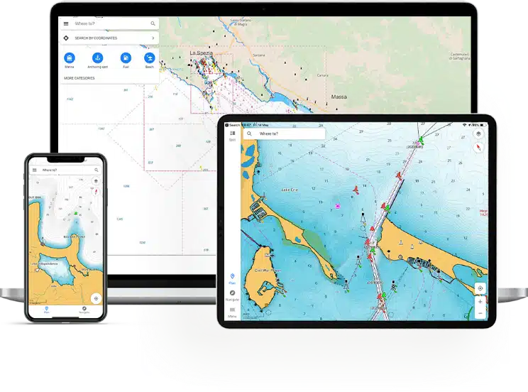
Navigating open waters without proper tools is not only daunting but can be dangerous. That’s where boat navigation apps come into play. In today’s digital era, these apps have revolutionized the way boaters sail, providing real-time data, detailed charts, and an array of features that enhance both safety and convenience. Whether you’re planning a day trip along the coast or crossing the Atlantic, a reliable navigation app is your best companion on the water.
Comparison of Boat Navigation Apps
App
User Base
Unique Features
Charting Capabilities
Pricing
Navionics
Large
Sonarchart™, auto-routing, community updates
High
Subscription with free 15-day trial
Aqua Map
Medium
Offline charts, AIS, anchor alarm
High
Free with in-app purchases
C-Map
Medium to Large
GRIB weather integration, auto-routing
Medium to High
Subscription-based, various tiers
iNavX
Medium to High
Waypoint navigation, onboard integration
High
Free, but charts sold separately
OpenCPN
Small to Medium
Open-source, supports various chart formats
High (with supported formats)
Free
KnowWake
Small to Medium
Business discovery, user-generated content
Low to Medium
Free
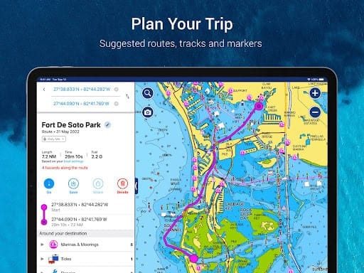
1. Navionics
Overview
Arguably the most recognized navigation app for boaters, Navionics stands out for its rich features and user-friendly interface. It delivers an impressive range of capabilities that make chart navigation effortless for both novice and seasoned sailors.
Key Features
Nautical Charts and Sonarchart™: Accurate nautical charts paired with high-definition bathymetric maps make it ideal for detailed marine exploration.
Dock-to-Dock Auto-Routing: Allows users to plan routes from one dock to another with minimal effort, calculating the best path automatically.
Community-Sourced Updates: Real-time updates from fellow boaters keep the charts fresh and ensure safety, such as marking hazards or updates to local infrastructure.
User Experience
Navionics users rave about the app’s intuitive interface and seamless route planning, making it an essential tool for cruising, fishing, and even racing. Testimonials suggest that it’s easy to understand and accurate, often cited as the gold standard in boating navigation.
Pricing
Navionics operates on a subscription model, with a free 15-day trial for new users. After the trial, a subscription unlocks continuous updates and premium features.
2. Aqua Map
Aqua Map
Overview
Aqua Map is another favorite among boaters due to its comprehensive features and offline functionality. Whether you’re in remote waters or cruising the coast, Aqua Map has you covered with detailed charts and reliable real-time data.
Key Features
Offline Charts: Download detailed offline charts for use without internet access, ensuring your routes stay accurate no matter your location.
AIS Integration: Automatic Identification System (AIS) integration provides real-time tracking of nearby vessels, enhancing safety during crowded conditions.
Anchor Alarm & Remote Monitoring: The app features an anchor alarm with remote monitoring capabilities to notify you if your anchor drifts.
User Experience
Users have praised Aqua Map for its detailed charts and the community sharing feature, which allows for the exchange of tips and data among boaters. Many commend its ease of use, especially when it comes to route planning and anchor alarms.
Pricing
While the app itself is free, in-app purchases and subscription options are available to unlock premium features like AIS integration and advanced charts.
3. C-Map
C-Map
Overview
Known for its easy-to-navigate interface and high-quality charts, C-Map offers a perfect balance of accessibility and depth. It’s a favorite among both recreational boaters and professionals.
Key Features
Automatic Routing: Similar to Navionics, C-Map provides auto-routing features that help plan the best and safest routes between waypoints.
GRIB File Integration: Provides real-time wind and weather data via GRIB files, allowing boaters to make informed decisions while navigating.
Navigation Aids: Extensive navigation aids such as buoys, lights, and markers enhance your situational awareness.
User Experience
C-Map has garnered positive reviews for its user-friendly interface and detailed charting options. Recreational boaters love it for casual use, while serious sailors rely on its high-accuracy data for longer voyages.
Pricing
C-Map offers several subscription tiers, allowing users to purchase coverage based on the regions they sail. Each tier varies in price, but all offer premium charting features and updates.
4. iNavX
iNavX
Overview
For sailors looking for versatility and powerful navigation tools, iNavX delivers a wealth of features designed for serious maritime navigation. It supports an extensive range of charts and integrates with onboard systems, making it perfect for long voyages.
Key Features
Integration with Onboard Systems: Seamlessly connects with onboard systems such as GPS receivers, making navigation more precise and reliable.
Extensive Chart Options: Access to a wide range of charts from NOAA, Navionics, and others, ensuring you have the best mapping available for your specific needs.
Waypoint Navigation: The app allows detailed route planning using waypoints for precision sailing.
User Experience
Many sailors consider iNavX an essential tool, particularly for its role as a backup navigation system. Users appreciate its compatibility with various charts and systems, although some note a steep learning curve for beginners.
Pricing
The app is free to download, but users will need to purchase additional charts, which can be pricey depending on the coverage area required.
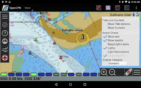
5. OpenCPN
OpenCPN
Overview
For the open-source enthusiasts and experienced sailors, OpenCPN offers a robust and flexible platform. It’s community-driven and supports a wide range of chart formats, making it a popular choice among professional sailors.
Key Features
Various Chart Formats: Supports multiple chart formats, including S-57 and S-63, ensuring you have access to the charts that suit your needs.
AIS Target Tracking: Offers AIS tracking for monitoring nearby vessels, enhancing safety in busy shipping lanes.
Weather Data Integration: Provides detailed weather data to help boaters navigate safely in changing conditions.
User Experience
OpenCPN users love the app’s flexibility and the community-driven updates. However, the steep learning curve and more technical setup might deter less experienced boaters.
Pricing
The app is free, making it an excellent option for those who prefer community-supported software. The community also provides frequent updates and support.
6. KnowWake
KnowWake
Overview
KnowWake is a unique app designed not only for navigation but also for discovering local businesses around your area. Whether you need to find marinas, fuel stations, or even dining spots, KnowWake has you covered.
Key Features
Business Discovery: Locates marinas, fuel stations, and restaurants around your sailing area, providing a seamless on-water experience.
User-Generated Content: Like Waze for boaters, user-generated content updates the maps with new spots, hazards, and reviews.
Easy Interface: The app is designed for simplicity, making it user-friendly for both experienced and novice boaters.
User Experience
Boaters appreciate KnowWake for its practicality and ability to discover local amenities on the water. The app is particularly useful for day trips where refueling and rest stops are needed.
Pricing
KnowWake is free to use, which adds to its appeal for casual boaters looking for a simple yet effective tool.
Conclusion
Boating is an exhilarating experience, but without proper navigation, it can quickly turn stressful or dangerous. Boat navigation apps simplify this process, providing real-time data, accurate charts, and a variety of tools to ensure you sail safely and efficiently. Whether you’re a casual boater or a seasoned sailor, one of these apps will enhance your journey.
Take the time to explore these options. Each app offers unique features that cater to different types of boaters. From detailed charts to community-driven updates, these navigation tools provide unmatched safety and convenience for every voyage.